A common mistake we see on Laramie job sites is starting a deep excavation without a rigorous geotechnical design that accounts for the Casper aquifer. The Laramie formation sandstone and saturated shale beds that underlie Albany County can transition from stable rock to flowing ground within a few feet. When a contractor hits a perched water table at 15 feet without an engineered dewatering and support plan, the cost overruns pile up fast. Our team develops excavation designs that integrate the IBC Chapter 18 requirements with local hydrogeologic data from the City of Laramie’s well logs, avoiding those surprise shut-downs. For projects near the University of Wyoming campus, where adjacent structures are sensitive, we often combine the deep excavation analysis with a seismic refraction survey to map the top of bedrock before shoring design begins, and we rely on test pits to verify the fill thickness in older downtown lots where historical maps are unreliable.
In Laramie’s bedrock, basal heave is often the controlling failure mode, not wall deflection.
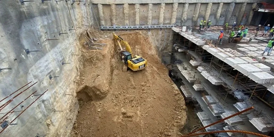
Local geotechnical context
The freeze-thaw cycles of Laramie’s 7,200-foot elevation create a risk that warmer climates never face: a perfectly stable shale cut in October can spall and ravel by February, overstressing the lagging and allowing progressive loss of ground behind the wall. This thermal cycling, combined with the rapid spring snowmelt that raises the Laramie River by several feet in weeks, demands a drainage system behind the shoring that won’t clog with fines from the decomposed granite residuum. Another local hazard is the presence of abandoned coal mine entries from the late 1800s in the hills east of town; an excavation without a pre-construction ground scan can break into a collapsed drift, causing sudden loss of support and a sinkhole that propagates to the surface. Our designs incorporate a conservative factor of safety of 1.5 on passive resistance in these mined-out zones and specify sealed lagging to prevent soil piping.
Questions and answers
What depth triggers a mandatory geotechnical excavation design in Laramie?
Per OSHA 29 CFR 1926 Subpart P, any excavation deeper than 5 feet requires a protective system designed by a qualified person, and excavations over 20 feet must have a design sealed by a registered professional engineer. In Laramie’s variable bedrock conditions, we recommend a site-specific geotechnical analysis for any cut exceeding 8 feet that will remain open for more than a week.
How much does a deep excavation design for a Laramie project typically cost?
The fee for a complete excavation design package in Laramie—including subsurface characterization, shoring calculations, dewatering analysis, and stamped plans—ranges from US$2,360 for a straightforward single-tier cut in competent sandstone to US$7,840 for a complex urban excavation with tiebacks, adjacent historic structures, and groundwater control systems.
What happens if we encounter groundwater during excavation in Laramie?
The Casper aquifer and perched water in the Satanka formation are common in the Laramie basin. If unanticipated groundwater is struck, our design includes contingency dewatering specifications: we can mobilize wellpoints or deep wells to lower the water table, and we design the base slab or invert to resist uplift pressures calculated from the measured artesian head.
Do you design the excavation support for the Laramie winter conditions?
Yes. Our designs account for freeze-thaw degradation of the exposed shale face by specifying a sacrificial weathering allowance or shotcrete facing that protects the cut from ice lensing, and we detail the drainage system to function when the ground is frozen at the surface but thawing at depth during chinook wind events.
Can you design an excavation adjacent to an existing building in downtown Laramie?
Yes, we specialize in underpinning and shoring designs that limit building settlement to less than a quarter inch. Using numerical modeling of the soil-structure interaction and a pre-construction condition survey, we design a system that protects the adjacent property and meets the Laramie Municipal Code’s requirements for protection of adjoining structures.