Overlooking subsurface variability in the Laramie Basin remains one of the costliest oversights a project can make, especially when drilling alone cannot distinguish saturated clay from tight bedrock. We see projects near the Laramie River where unknown paleochannel deposits later forced foundation redesigns that could have been avoided with a preliminary geophysical survey. Electrical resistivity—specifically Vertical Electrical Sounding—maps these contrasts by measuring how the ground resists current flow, revealing clay lenses, water tables, and fractured granite before excavation begins. For sites around the Monolith or east toward the Happy Jack area, the technique clarifies what lies beneath the sparse sagebrush, without extensive trenching. When combined with CPT testing in alluvial zones, resistivity data creates a reliable cross-section of the subsurface before heavy equipment arrives on site.
In the Laramie Basin, resistivity profiling often reveals a perched water table at 15 to 30 feet that drilling logs miss entirely—a distinction that changes foundation drainage requirements overnight.
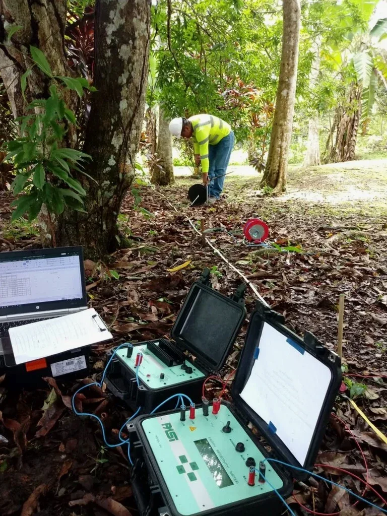
Methodology and scope
Laramie's development spread from the Union Pacific railroad corridor outward into the Laramie Range foothills and across Quaternary basin fill, creating a patchwork of subsurface conditions that no single investigation method can fully resolve. The city sits at roughly 7,165 feet elevation, where seasonal freeze-thaw and the shallow Sherman Granite contact introduce sharp resistivity contrasts that our field crews have calibrated over numerous basin surveys. A Vertical Electrical Sounding array typically expands from a few meters to over 200 meters in electrode spacing, allowing depth penetration proportional to the array length. Our equipment uses a multi-electrode system with automatic stacking to filter out cultural noise from nearby power lines and railroad signals, which is a persistent challenge in parts of Laramie's west side. Data inversion runs through constrained least-squares software that matches the resistivity model to the local stratigraphy we know from borehole logs across Albany County.
Questions and answers
How deep can a resistivity survey see in the Laramie Basin?
Depth of investigation depends on the array geometry and electrode spacing. With a standard Schlumberger VES spread expanding to 200 meters AB/2, we typically achieve reliable penetration to 60-100 feet in the basin fill. Penetration decreases in highly conductive clay layers or where shallow groundwater creates a screening effect. For deeper targets beyond 100 feet, we often combine VES with seismic methods to constrain the interpretation.
What does a Vertical Electrical Sounding survey cost for a typical residential or commercial lot in Laramie?
For a standard VES at a single point with full data processing and interpreted cross-section, pricing generally falls between $540 and $1,070 depending on access conditions, array length required, and the depth of investigation needed. A 2D resistivity tomography line costs more due to the multi-electrode equipment and longer field time. We provide a fixed-price proposal after reviewing the site geology and project objectives.
Can electrical resistivity distinguish between clay and groundwater?
Both clay and groundwater-saturated sediments produce low resistivity values, which can create ambiguity if interpreted without geologic context. In the Laramie Basin, we resolve this by calibrating resistivity data against local borehole logs, measuring groundwater conductivity from nearby wells, and observing the resistivity gradient rather than absolute values. Shallow clay tends to produce a gradual decrease with depth, while a water table typically creates a sharper resistivity contrast.