← Home · Investigation

SPT Testing in Laramie: Data That Holds Up to Wyoming Wind

Together, we solve the challenges of tomorrow.

LEARN MORE →

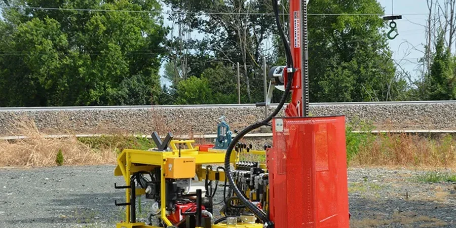
Laramie’s growth from a railroad tent city in 1868 to a university-anchored community at 7,165 feet elevation created a patchwork of older fill zones alongside undisturbed high-plains sediments. The Union Pacific rail yard and the University of Wyoming campus sit on very different subsurface profiles, and the shallow groundwater along the Laramie River introduces seasonal variability that surprises even experienced developers. When a project requires reliable bearing capacity data, the Standard Penetration Test provides the stratigraphic resolution that desk studies simply cannot match. Our team runs SPT drilling year-round, even when the thermometer drops below zero in January, because the geology here does not wait for construction season. For deeper profiling, we often combine SPT data with CPT soundings to resolve transitions between the Sherman Granite residuum and the overlying alluvial deposits that blanket much of the city.

N-values above 50 in Laramie usually mean you hit decomposed Sherman Granite, not a gravel lens—and that changes the foundation design entirely.

Methodology and scope

ASTM D1586 governs SPT execution in the United States, and in Laramie that standard gets tested by conditions that few coastal labs ever encounter. The Casper Formation sandstone and interbedded siltstone weather unevenly, producing refusal depths that vary by 10 feet across a single site. We run a calibrated automatic hammer on a CME-55 rig and record blow counts every 6 inches through the full 24-inch drive interval, noting any chatter or grinding that signals cobble contact. Grain-size distribution per ASTM D2487 often reveals silty fine sands with low plasticity that fall into borderline liquefiable categories under ASCE 7 seismic criteria. When we encounter those soils, we recommend supplementing SPT results with a liquefaction analysis to quantify the factor of safety for the design earthquake. Data sheets leave Laramie with depth-to-water readings, sample recovery percentages, and notes on drilling fluid loss that help engineers spot potential collapse zones before excavation begins.
SPT Testing in Laramie: Data That Holds Up to Wyoming Wind
Technical reference image — Laramie

Local geotechnical context

The Laramie Valley sits at the edge of a high semi-arid steppe where summer thunderstorms deliver cloudbursts that saturate the top three feet of soil in an afternoon, then freeze solid by October. That freeze-thaw cycling, down to a design frost depth of 60 inches per IBC Table 301.2, heaves fine-grained soils and disrupts SPT correlations if seasonal moisture content is ignored. The wind—sustained at 30 mph with gusts past 50 mph in January—poses a rig stability risk on exposed sites east of Third Street. We secure the mast with additional guy lines and suspend drilling during sustained gusts above 40 mph. A less obvious concern is the thin layer of expansive clay that traces the Laramie River floodplain; blow counts in that zone can look acceptable while the material swells enough to crack slab-on-grade foundations within two wet seasons. Recognizing that layer during SPT sampling prevents a mischaracterization that standard lab tests might miss until it is too late.

Need a geotechnical assessment?

Reply within 24h.

Email: [email protected]

Typical values

ParameterTypical value
Standard followedASTM D1586-18 (Standard Test Method for Standard Penetration Test)
Hammer typeAutomatic trip hammer, 140 lb weight, 30-inch drop
SamplerStandard split-spoon, 2-inch OD, 18-inch length (ASTM D1586)
Typical depth range in Laramie Basin10 to 60 ft, dependent on bedrock refusal
Blow count recordingEvery 6 inches for three 6-inch increments; N-value = sum of final two
Sample classificationASTM D2487 (Unified Soil Classification System – USCS)
Groundwater observationRecorded at completion and after 24-hour stabilization where feasible
Seismic referenceASCE 7-22 Chapter 11 (Seismic Design Criteria), IBC Site Class determination

Related services

01

Grain Size Analysis

Sieve and hydrometer testing per ASTM D422 on split-spoon samples identifies the silty fine sands and low-plasticity clays that dominate Laramie Basin alluvium.

02

Atterberg Limits

Liquid and plastic limit determination on the cohesive fraction flags the expansive potential of floodplain clays near the Laramie River corridor.

03

Footing Design Support

We translate SPT N-values into allowable bearing pressures and settlement estimates for shallow foundations, referencing IBC presumptive values and local precedent.

Applicable standards

ASTM D1586-18: Standard Test Method for Standard Penetration Test (SPT) and Split-Barrel Sampling of Soils, ASTM D2487-17: Standard Practice for Classification of Soils for Engineering Purposes (Unified Soil Classification System), ASCE/SEI 7-22: Minimum Design Loads and Associated Criteria for Buildings and Other Structures, IBC 2021: International Building Code, Chapter 18 (Soils and Foundations), OSHA 1926 Subpart P: Excavation safety requirements during drilling operations

Questions and answers

What depth do you typically drill for SPT in Laramie?

Most residential and light commercial borings reach 20 to 35 feet below grade. For taller structures or sites near the Laramie River where alluvial deposits run deeper, we extend to 50 or 60 feet, stopping at practical refusal on weathered bedrock. The actual depth adapts to what the split-spoon tells us about the soil profile in real time.

How much does an SPT boring cost in the Laramie area?

A single SPT boring to typical depth ranges between US$580 and US$710, depending on access conditions, depth, and the number of samples recovered. Mobilization fees adjust for distance from the city center and any winter-access requirements on unplowed lots.

Do you need to account for frost when interpreting SPT data here?

Absolutely. Laramie's design frost depth of 60 inches means the upper five feet of soil undergoes seasonal moisture and density changes that affect blow counts. We flag SPT data collected in the frost zone and recommend sampling below that depth for foundation parameter selection, especially for unheated structures like garages or agricultural buildings.

Location and service area

We serve projects in Laramie and surrounding areas.

View larger map